
Fossil Rocks from Envicom’s 2023
Discovery are Set Up at Cabrillo Aquarium
in San Pedro, California.
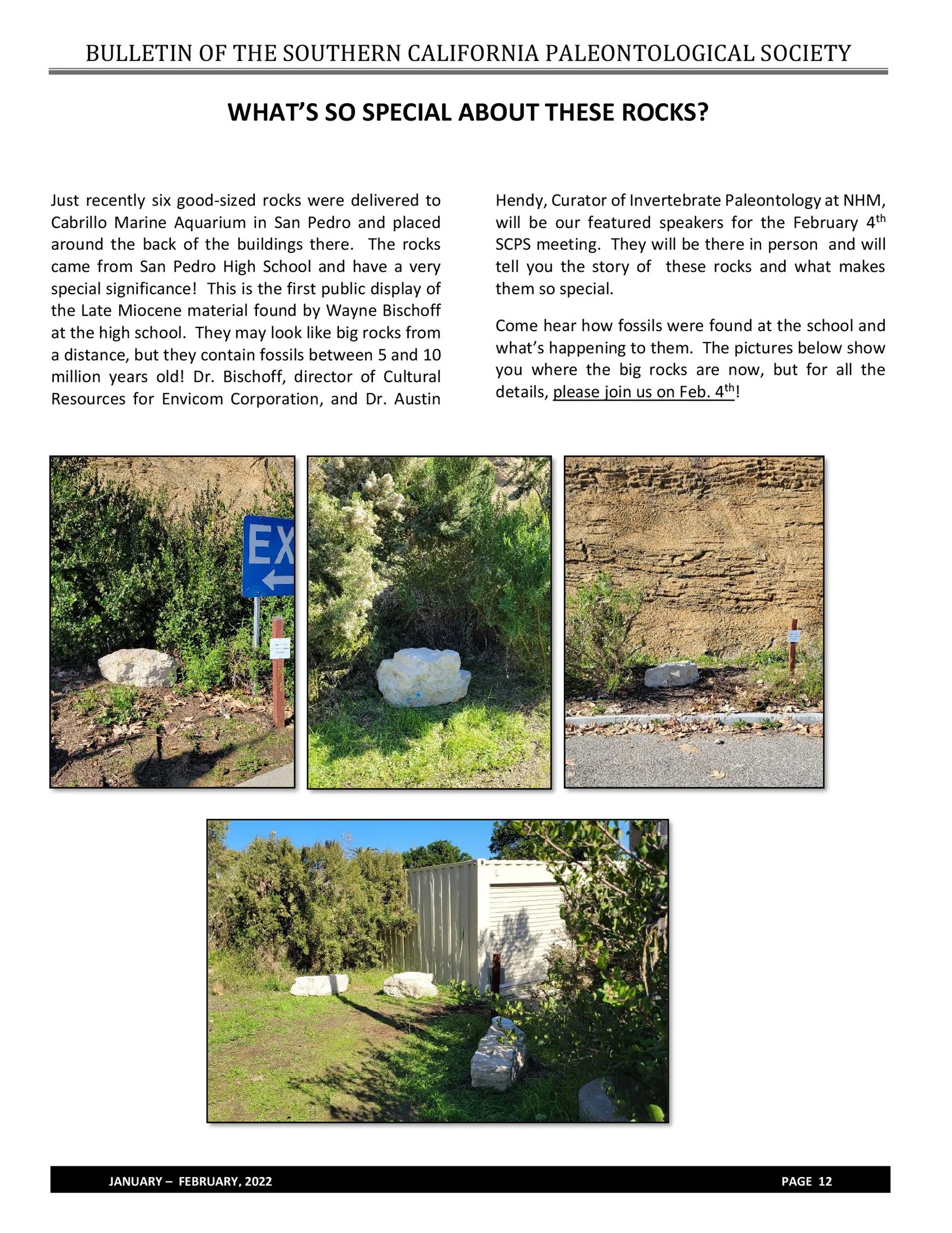
Rocks Containing Thousands of Fossils from Envicom’s 2023 Fossil Bonebed Discovery are Installed at Cabrillo Aquarium in San Pedro, California.
Envicom discovered in 2023 the largest marine fossil bonebed in Los Angeles and Orange Counties. Dr. Wayne Bischoff of Envicom has been working with staff from the Natural History Museum of Los Angles County to document the Late Miocene (8.7-million years ago) discovery. The millions of fossils found at the discovery site came from fish, sharks, dolphins, whales, sea turtles, seabirds, invertebrates, and ocean and shore plants. Many of the species discovered are now extinct, but many can still be found off California’s coast today.
As part of the discovery response, fossil rocks and samples will be provided to several educational institutions, including the Cabrillo Aquarium, for public display, interpretation, and education. Six large fossil rocks were recently set up in the Aquarium’s public garden, which was announced in the Bulletin of the Southern California Paleontological Society. Dr. Bischoff and Dr. Austin Hendy of the Natural History Museum will also be talking about the discovery at the Natural History Museum on February 4 th , 2024.

Daniel Neal, J.D.
Envicom Corporation is proud to announce that it has hired Daniel Neal, J.D. as its Director of Permitting & Compliance. Dan’s position is a new one, and he’ll be responsible for ensuring that Envicom’s clients continue to receive the highest levels of professional service as they obtain entitlements for their projects and carry their projects through construction into operation. Dan will be working remotely from his home office in Woodland, California. Dan’s technical background is in wetland delineation, waters permitting, project management, contract management, business development, and client support. At a previous consultancy, Dan has served as the contract manager for large on-call programs with Southern California Edison, the Pacific Gas & Electric Company, the Southern California Gas Company, and other utility, public, and private-sector clients. Prior to becoming a private environmental consultant, Dan worked in the Regulatory Division of the Sacramento District of the United States Army Corps of Engineers and was a CEQA litigator with the law firm of Best, Best & Krieger LLP. Dan graduated from the U.C. Davis School of Law, has an A.S. in Biology and a Field Ecology Vocational Certificate from Sacramento City College, and a B.A. in English Literature from Santa Clara University.
The Oak Canyon Community Park Duck Pond

Above: Red Eared Slider, held in a collection bin prior to its transfer to a nearby turtle sanctuary. Below: Photos below depict turtle round-up and turtle education to local volunteers.
The Oak Canyon Community Park Duck Pond, located within Oak Canyon, was burned and damaged during the 2018 Woolsey Fire and during subsequent winter rains, sediment, ash and debris washed down into and filled the ponds, culvert and Medea Creek channel. The Oak Canyon Community Park Duck Pond Project, led by the Rancho Simi Recreation and Parks District (RSRPD), aims to restore the pond area to pre-Woolsey fire conditions.
There are a different species that previously resided in the Oak Canyon Pond, including the red eared slider, and southwestern pond turtle. The Southwestern pond turtle (Emys marmorata) is a native turtle species and is threatened by the invasive red eared slider (Trachemys scripta elegans) which often compete with southwestern pond turtles for food and transmit diseases. One of the Project goals was to round-up turtles prior to initiation of construction and transport any non-native red eared sliders to a turtle sanctuary in Arroyo Grande, and relocate southwestern pond turtles with the assistance of a designated biologist and turtle expert.
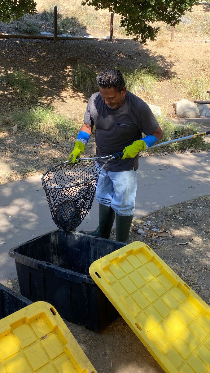
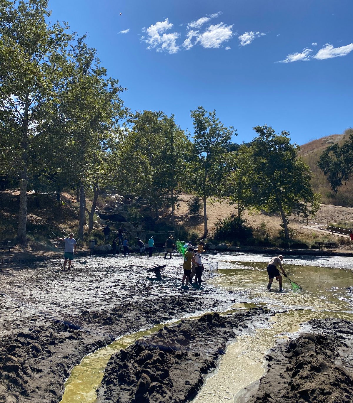
On June 30, 2022, Envicom assisted over a dozen community volunteers and Park staff members in a turtle round-up. Volunteers geared up in rubber boots and gloves, and waded through the mud-soaked pond area to round up any turtles with hand nets. Multiple red-eared sliders were captured during the round-up for transfer to the sanctuary, and the biologist provided turtle education for local volunteers.

Our unique cloud-based GIS platform
Envicom is excited to announce the launch of Nexus, which enables us to deliver sophisticated GIS applications for unique data insights, including web mapping applications and data dashboards that provide complete situational awareness, geospatial analysis, custom fleet management, and highly configurable, automated data reports. Coming soon we will also offer a native mobile application for map-based data collection with offline capability (iOS & Android). At Envicom, we thrive on using maps and data to solve problems and create opportunities for our clients. Contact us to discuss your unique project needs. Proudly partnered with the MapGears team of developers, who help us make geospatial magic happen.
#gis #webmaps #geospatial #envicom #envicomgis #mapgears #opensource

Envicom's GIS Team Assists with COVID-19 Mapping Project
GISCorps is an organization that coordinates the voluntary assistance of short-term, highly specialized GIS expertise to improve the well being of developing and transitional communities. Envicom's GIS team has provided their skills on multiple GISCorps projects over the past few years, and so were glad to respond when we received their Mission Recruiting Announcement at the end of March. The request to GISCorps came from ESRI's Disaster Response Team, who need assistance to create and maintain a nationwide dataset of all COVID-19 testing locations, along with up-to-date instructions and information pertinent to each testing site. Envicom's GIS team has adopted Ventura County, CA and we will maintain this important information for our home county until this crisis is over. Public access to COVID-19 Testing Site information is available here:
https://giscorps.maps.arcgis.com/apps/webappviewer/index.html?id=2ec47819f57c40598a4eaf45bf9e0d16

GIS Interface